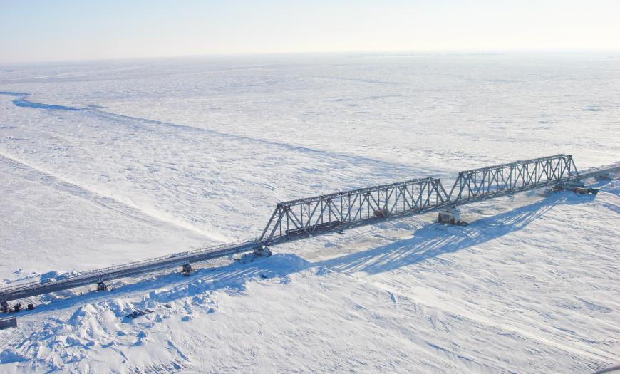
The railway bridge across the Yuribey River is the longest bridge crossing beyond the Arctic Circle. The facility is located on the Obskaya — Bovanenkovo railway line, the project of which was developed by Lengiprotrans in the 1980s for the development of the Bovanenkovskoye and Kharasaveyskoye oil and gas fields. Due to the economic crisis of the late 1980s, the pace of construction slowed down significantly. In 2004, a decision was made to resume construction, within the framework of which a bridge was erected over the Yuribey River.
The wide floodplain of the Yuribey River, which is about 4 km long, has become the main barrier point in the northern section of the Obskaya — Bovanenkovo line. The river bed is only 200–300 m wide, but during the period of maximum flooding it reaches 3–4 km. Also, the design was complicated by the difficult climatic, geocryological and hydrological conditions of the Yamal Peninsula.
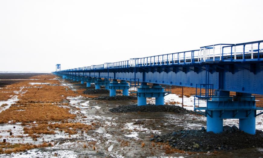
When designing, two options were considered for crossing the floodplain of the river — with the filling of embankments at the approaches to the bridge and with the construction of an overpass across the entire floodplain. Taking into account the cost of transporting rocky soil for embankments, as well as environmental requirements, preference was given to the second option. The construction of the bridge on high piles without soil filling contributed to the preservation of the river's ecosystem.
As a result, a metal bridge was designed with approach overpasses according to the scheme 82x34.20 + 2x110.0 + 25x34.5 m and with supports made of hollow shell piles with a diameter of 1420 mm. The structure contains 107 standard spans 34 m each and 2 end-to-end trusses 110 m each. Bridge supports, which go 20–40 m underground, due to special technologies firmly adhere to permafrost soils. The total length of the structure is 3.9 km.
Design of the Obskaya — Bovanenkovo — Karskaya railway line
Author's department:
Project Status:
Northernmost railway line


