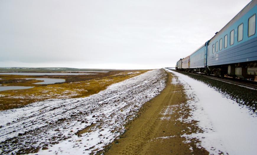
In the 1980s, Lengiprotrans developed a project for the Obskaya - Bovanenkovo line, the northernmost railway in the world. The road was intended for the development of the Bovanenkovskoye and Kharasaveyskoye gas fields on the Yamal Peninsula. In the early years, construction proceeded at an intensive pace, but with the onset of the economic crisis of the late 1980s, it significantly decreased. By the early 2000s, the line was laid to the Khralov junction (km 267), named in memory of the chief engineer of the Lengiprotrans Institute A.Ya. Chralov.
In 2004, the Yamal Engineering Center was established to resume the construction of the road. In the same period, the investment feasibility study for the development of the Bovanenkovskoye gas field was approved. Corrections were made in the direction of the route with respect to the previous option: the line was extended to the North of Yamal to the Karskaya station and shifted to the East - closer to the watershed and promising gas fields.
Lengiprotrans carried out a significant amount of design work, including the design of the track section, subgrade and artificial structures. In 2007, the institute carried out surveys on the section from km 483 to km 550 (Bovanenkovo-promyshlennaya station), as well as some work at the Obskaya station.
The design of the line was carried out in difficult climatic, geocryological and hydrological conditions of the Far North. The region is characterized by a harsh climate, widespread permafrost and heavy snow load. This led to the development of extraordinary solutions during the design.
During the construction of the southern section of the line along the slopes of the Polar Urals, a two-stage technology of subgrade construction was used. According to this technique, during the summer season, the soil taken from the quarries and laid in piles was dried. However, due to the tight deadlines to the north of the Khralov junction, the only possible one-stage technology for the construction of the roadbed. Frozen soil was laid in the embankment, wrapped in geotextile holders, with the use of an insulating layer of expanded polystyrene. Both methods were developed by the engineers of Lengiprotrans during the design of the route in the 1980s.
There were no drainage sands suitable for filling the subgrade in the northern section of the road. In this regard, frozen silty sands with a low filtration coefficient and a high ice content were used.
The wide floodplain of the Yuribey River with a length of about 4 kilometers became the main barrier point in the northern section of the route. A unique flyover was built - the longest over the Arctic Circle.
In 2010, the Obskaya - Bovanenkovo - Karskaya railway line was put into operation. In the future, it is planned to extend the route to the Kharasavey village on the coast of the Kara Sea, as well as to the Sabetta shift camp and the Novy Port village.
Design of the Obskaya - Bovanenkovo - Karskaya railway line
Author's department:
Northernmost railway line


